Auction: 25360 - The 360th Anniversary Sale
Lot: 26
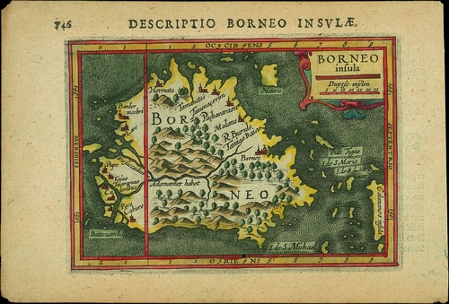
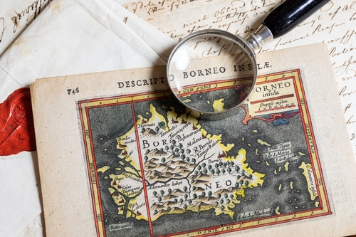
A SUPERB 17TH CENTURY COLOURED MAP OF BORNEO
A coloured map of Borneo (modern day Sabah), printed on laid paper, designed by Petrus Bertius (1566-1629) headed "
178mm x 120mm.
A very early and delightful map. Small pin hole at foot otherwise of wonderfully fresh colour and charming appearance.
Petrus Bertius was a Flemish philosopher, theologian, historian and cartographer; or in other words, a true Renaissance man! In philosophy and theology he is remembered for his Hymenaeus Desertor which was later translated into Dutch. His first contribution to cartography was recorded in 1598; It was not until 1618 that he was appointed as cosmographer to the court of Louis XIII, King of France.
Between the 15th and 17th Century, the majority of the coastal areas of Borneo were under the rule of the Bolkiah, Sultan of Brunei. The Dutch Empire would later attempt to settle on the Island, ultimately withdrawing, and in 1812 the Sultan ceded to the British East India Company. It remained a member of the British Empire into the 1960s. Its issues of Postage Stamps and Banknotes are popular collecting areas among Philatelists and Banknote collectors.
Subject to 20% VAT on Buyer’s Premium. For more information please view Terms and Conditions for Buyers.
Sold for
£600
Starting price
£1666


Watch, listen and bid as if you were in the room. Now available for auctions worldwide.
Click here to bid live
An exclusive and confidential service for the discerning collector or vendor.
View the Gallery
Download every Spink catalogue on your iPad, iPod or iPhone using free Spink app.
Download From iTunes© 2026 Spink & Son. All rights reserved.