Auction: 15040 - Antique Maps sale during the International Exhibition
Lot: 200
Maps
Pacific Ocean
French Polynesia
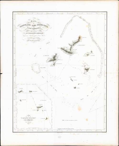
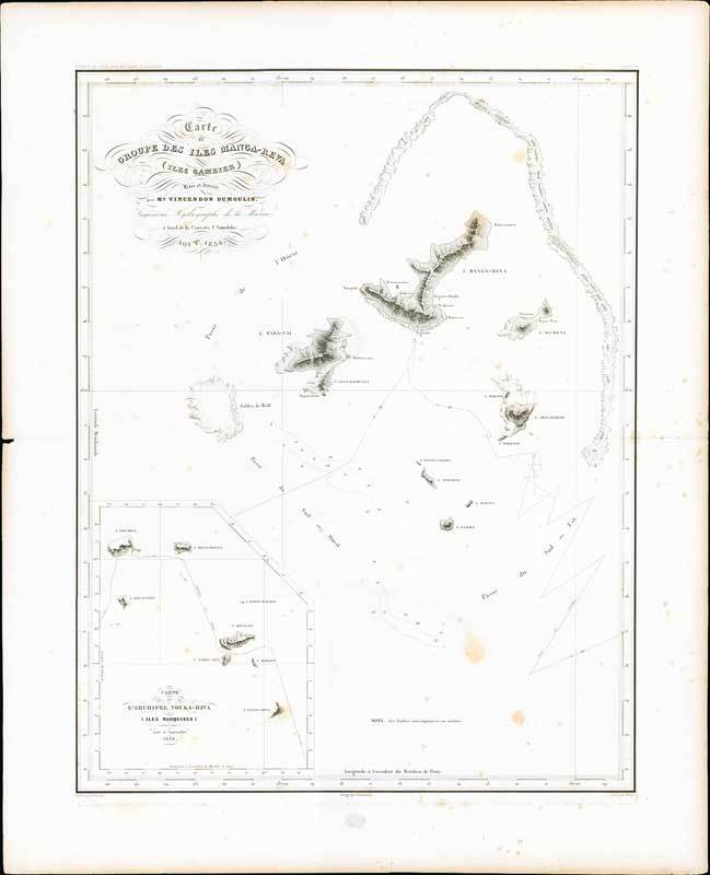
1838 Carte groupe des Iles Manga-Reva (Iles Gambier) Levee et dressee par Mr. Vincendon Dumoulin Ingenieur hydrographe de la marine a bord de la corvette L'Astrolabe, by Depot des cartes et plans de la marine, France; 21 x 26 inches; uncoloured.
Chart of the Mangareva Islands with relief shown by hachures and bathymetric soundings. Track of Dumont d'Urvilles corvettes shown with inset of Carte de L'Archipel Nouka-Hiva (Iles Marquises) aout et septembre 1838.
Central fold, tone spotting. Photo
Estimate
SG$500 to SG$600

Watch, listen and bid as if you were in the room. Now available for auctions worldwide.
Click here to bid live
An exclusive and confidential service for the discerning collector or vendor.
View the Gallery
Download every Spink catalogue on your iPad, iPod or iPhone using free Spink app.
Download From iTunes© 2025 Spink & Son. All rights reserved.